Description
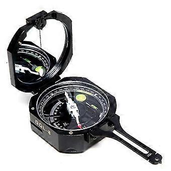
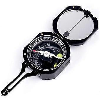
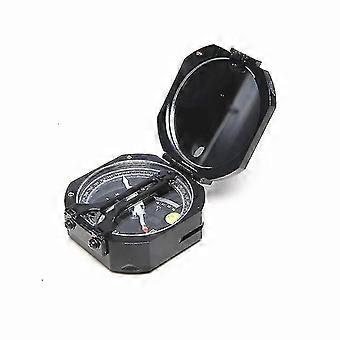
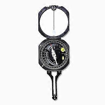
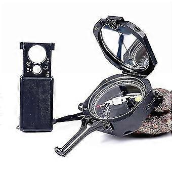
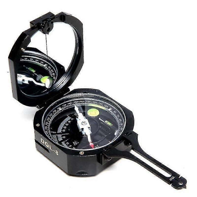
Dql-8 Geological Compass High Precision Damping Anti Magnetic-c
DQL-8 Geological Compass High-Precision Damping Anti-Magnetic
[Specifications]:
1.*Dial: 0 to 360 , : 1 ;
*Azimuth dial: outer calibration instructions for slope (two-way 45 slope Angle of tangent ), the lattice : 0.05;
*Inner ring calibration instructions for two-way 90 slope Angle, unit: degree; : 1 .
2.Magnetic damping time (needle deflection 90 to stay in the original position of the time) is less than 15 seconds;
3.Reading error:
A. magnetic rotation before and after the indicated the degree of error is not more than 0.5 ;
B. needle on a scale of 0-180 180 , 90 - caused by eccentric error is not more than 0.5 ;
C. goniometer reading error is not greater than 0.5 .
4.Sensitivity level:
A. long level for 15'3'/2mm
B. circular bubble for 30'5'/2mm
5.Size:80x70x35mm
6.Net weight:0.29kg
Magnetic Declination:
Magnetic declination, sometimes called magnetic variation, is the angle between magnetic north and true north. Declination is considered positive east of true north and negative when west.
For more information, please see : ngdc.noaa
If the compass needle points east or west of the true north, the offset is called east or west declination, respectively. The standard is to use the magnetic north (MN) as a reference for declination, even in the southern hemisphere.
For more information, please see : Geology in the Field by Robert R. Compton (Jul 1985)
Estimated of Magnetic Declination:
Declination is calculated using the current World Magnetic Model (WMM) or the International Geomagnetic Reference Field (IGRF) model. Declination results are typically accurate to 30 minutes of arc, but users should be aware that several environmental factors can cause disturbances in the magnetic field.
For more information, please see : ngdc.noaa
Setting The Declination:
Geologists use the compass for mapping and measuring linear and planar objects. The magnetic declination is set by turning the brass screw on the side of the compass box.
For more information, please see : Geology in the Field by Robert R. Compton (Jul 1985)
[How to use]:
One:
The occurrence (including towards, orientation, Angle)
1.Measure move towards:To the dike on the horizontal projection direction.
Open the instrument on the cover to the limit position, adjusted the magnetic declination in the region, the instrument two long edges on the characteristics of the rock surface (the typical surface), keep centered round blisters, reads the degree, indicated by the magnetic North Pole is the rock.
2.Measure tendency:The direction perpendicular to the direction indicated.
With link at the bottom of the hinge on the chassis of the short side or the back of the cover of the anchored rock characteristics of the surface, keep centered round blisters, reads the degree, indicated by the magnetic North Pole is the tendency of rock.
3.Measure inclination:Perpendicular to the direction of horizontal Angle Angle.
Open the cover to the limit position, the side of the instrument perpendicular to the direction and with the characteristics of the rock face, the bubble in the middle and long read pointer refers to the steering wheel, the degree is the dip Angle of strata.
Notice:In actual measurement, the trend and tendency of the two factors, one can simply test, because the trend and tendency is 90 relationship each other.
Two:
Terrain sketch survey (including bearing, slope Angle, horizontal line)
1.Make cardinal direction:Target's direction and position. Bearing is also called the intersection point.
(1) when the target above the line of sight (horizontal) measurement method.
*Right hand clenched instruments, cover the back towards the observer, the arm against the body, to reduce jitter, adjust the diopter and left hand mirror, turn the body, make the goal, like at the same time of sighting a long mirror, and divide by mirror line, keep centered round blisters, reads the degree, indicated by the magnetic North Pole is the target's direction.
*According to the same method, to measure the goal in another point, these two point to the measurement of the same target two line along the measure of the degree, meet in the goal, it is concluded that the location of the object.
(2) when the target under the line of sight (horizontal) measurement method.
*Right hand instruments, mirror across from the observer, the arm against the body, also in order to reduce jitter. Adjust the diopter and left hand on the cover, turn the body, make the goal, sighting, pointed at the same time into the mirror of the elliptical hole, and divide by mirror line, keep the center circle blisters, and then read the degree, indicated by the magnetic North Pole is the target's direction.
*According to the same way, in another point
-
Fruugo ID:
366629861-793932641
-
EAN:
686331046667